

We are back on the road, this time to Alaska. It should be fun +++++ You can track our trip on a map by pasting this into your browser +++++ https://share.delorme.com/TaylorTravels +++++ Please enjoy, come back often, and let us know what you think.
Tuesday, July 26, 2016
Monday, July 25, 2016
25 July. Some thoughts on the journey.
In some sense, on the 16th of July when we
arrived in Tok, Alaska, it felt as though our trip was half way complete. And,
that could be true in terms of mileage. But more than that, we had completed
most of our loop of Alaska, so it felt like an achievement, like we were on our
way home. We had spent so much time in
the middle of nowhere, in the outback of North America, in the beyond, in BFE, that
we had become used to it. Finding a
single gas station stocked with a few cokes and a few candy bars after
traveling 200 miles on lonely pavement through trees and lakes seemed
normal. A quick thought brought me back
to reality. A mile walk, behind that gas
station, would put me in the deep wilderness of the circumpolar boreal
forest. I imagined that French trapper,
who in say 1800, had not seen another human face in months, maybe years. That thought could quickly run a streak of
fear into the most fearless heart.
Tok.
If it had been a hippie town, like others we experienced along the way, the
pronunciation might have recalled a head shop in Anytown, USA. But though civilized, Tok was is just a
smudge on the continental canvas: a couple of RV parks, a gas station or two,
an outdoor shop the size of a 7-11 but stocked like an REI flagship, a garage,
a restaurant: Fast Eddie’s. All that,
and Tok still felt like the start of the way home. Then I was jolted back to reality when I
reviewed the map. With a drive to Haines
along the way, and a side trip to Stewart/Hyder, Tok lies nearly 2,500 miles
from the US border near Seattle. That is
a long way.
Pulling from the RV parking lot from Tok, we faced a section
of road that was the unknown and came with bad condition reports—the Alaska
Highway though Destruction Bay and Haines Junction. It was reportedly torn up with pot holes,
mud, gravel…all the things you don’t really want while pulling a trailer. This
we had heard on the way north weeks back. We discovered the old report was
already out of date. Canadian road builders are not messing around. They can make repairs in a few short weeks
taking advantage of every bit of daylight in a very short construction
season. Heck, it’s July and we have
already seen some leaves starting to change.
Tundra and boreal forest roads need continual yearly repair. They’re
built on permafrost, a geologic feature that’s the sworn enemy of roads and
permanence. Canadians know this. Alaskans, not so much. Our worst sections of roadway on this trip
were undeniably in the US. No
question. Is it tax base, or commitment? That’s the subject of another blog post, one
you will likely not read from me.
500 miles ESE of Tok we returned to Baby Nugget RV Park
about 15 miles west of Watson Lake, Yukon and spent the night before heading
out on the Cassiar Highway. This stretch
of pavement running north-south through western British Colombia didn’t exist
until 1972. Nearly 500 miles, it
represented our last look at primordial Canada, endless forests to the horizon
in all directions, ubiquitous snow-capped mountain ranges so prevalent, you
grow bored looking at them. And so many lakes you can’t help wondering where
all the water comes from. About 25 feet
wide with no shoulders and few guard rails, we drove in tandem with John and
Pam for nearly three days shrouded in rain and mist. We had negative thoughts about the prospect
of a postage stamp RV park in a little spot called Iskut. We were surprised to
find one of the most beautiful settings and well-kept parks we had yet
seen. Next stop was Stewart, BC on the
point of a fjord with Hyder, AK on the opposing side. These two towns were lost in time. Stewart was in better shape, but Hyder was an
abject demonstration of US poverty. We imagined the postal clerk (yes, there
was a post office) was the highest paid person in town. That until we met a few
US Forest Service pros who had spent their careers in Hyder. A plea to the Governor of Alaska: The place needs help. Thousands of tourists visit annually. It’s
simply an embarrassment. Natural beauty aside, it should be a jewel.
Next stop, the Municipal Park at Smithers, British Columbia.
We knew nothing about it, so made assumptions based on the size of the font on
a tiny map. But WOW! What a place!
Who knew National Geographic Traveler had named it one of the top
ten best-kept-secret ski destinations in North America. A little town with a lot of German influence,
it looks and feels like a ski town. You know when there’s a McDonalds and when
the Safeway even has a Starbucks, you are in the big time. And the RV park? Amazing. Right on the Bear River, it sported,
by far, the largest RV spaces we’ve seen.
Grass, trails, full hook ups, a mowed field to play Frisbee with Bean.
What more could anyone want? Here was a
town whose local government watched a thousand RVs a day pass by and said, “We
can make some revenue from these folks.”
As I write this in a little park outside Prince George, BC
we are back in civilization again. I
could take your blindfold off anywhere and you’d swear you were in “Anytown”
USA. Tomorrow 100-Mile House. Wednesday: Whistler, BC. Friday:
Vancouver, BC. Monday: Vancouver
Island. It’s going fast. It’s coming to
an end. Then I look at the map and
consider the drive from the Olympic Peninsula to Austin, Texas…just 2,500
miles.
Alaska is a fur piece. But we wouldn’t trade the experience
for the world.
Sunday, July 24, 2016
24 July. Further south.
Bear Creek RV park in Stewart, BC was a nice little place, though due to the constant rain it was difficult to enjoy. We departed the morning of the 24th to some sky with blue patches and managed to see some of the beauty of the Cassiar Mountain Range we had missed on the way from Watson Lake.


This is Bear Glacier. You can't see it all in this photo. It feeds Bear Lake in the foreground which is the source of Bear River that flows into Stewart.
Saturday, July 23, 2016
23 July. Going for bear in Hyder, Alaska
40 miles west of nowhere off the Cassiar Highway in western British Columbia lies the little town of Stewart. It must be some sort of fishing village. With Bear River access to the Pacific Ocean, it lies at the intersection of the Bear River (Stewart side) and the Salmon River (Hyder Side). It's another one of those locations that you may have seen in photos. In Hyder, just across the Alaskan border (about as far south on the Alaskan panhandle as you can get, lies a US Forest Service boardwalk from which you might see grizzly and/or black bears feasting on salmon. They (the salmon) had just begun running a few weeks before. Bears had been seen, but sadly we missed them. But we did see the fish.


Rain, a staple of the area helped grow the largest Sitka spruce trees we had seen. 10 feet in diameter at least.

This is a little tributary of the Salmon River.

Chum Salmon...also called Dog Salmon. They are reportedly twice the normal size in this river. The two in this photo exceed 24 inches long.
Tuesday, July 19, 2016
19 July, Haines, Alaska Day 2
We had just two nights in Haines, but we made the most of them. Mary and I had gotten a great bike ride in on the previous night ... 21 miles round trip to Chilkoot Lake. Then on the 19th John, Mary and I climbed Mt Riley. Pam stayed back and did a walk on her own. The trail was reportedly difficult. That forecast hit.


This boardwalk protects the tundra at 1600 feet. I have climbed easier 14ers (Colorado's 14,000 foot peaks). Steep grades, roots, rocks, and tundra. It was the perfect workout.

John and Mary summit.


The trail to the summit was 3.2 miles each way. Much of it was through a forest of boreal Sitka spruce trees. They can grow up to 300 feet tall. Prized by luthiers (guitar makers) for guitar tops, the trees can get so heavy they crush their wood under their own weight. This makes a wood that is tonally excellent for musical instruments. I had never seen spruce tree so large.

This boardwalk protects the tundra at 1600 feet. I have climbed easier 14ers (Colorado's 14,000 foot peaks). Steep grades, roots, rocks, and tundra. It was the perfect workout.

John and Mary summit.

The view of the coastal mountains was spectacular.

Now all that remains is to start the downclimb. Our knees are already sore just thinking about it.

This glacier was visible across the fjord. Take a close look, you can see a huge waterfall, the product of glacial melt.
Monday, July 18, 2016
18 July, Haines, Alaska
You may have seen photos of Haines, Alaska even when you didn't know what you were looking at. Haines is the center of Alaska's Bald Eagle population. If you have seen photos of hundreds of Bald Eagles in trees and on rocks and such, the photo was likely taken in Haines. The place is stunningly beautiful. We did not see hundreds of eagles, but we did see dozens.


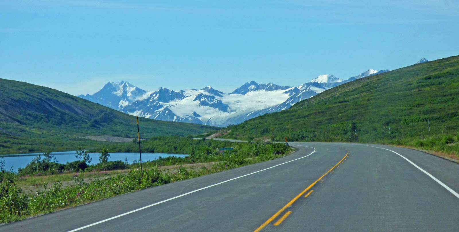
This stretch of road in Yukon headed toward Alaska we had the best stretch of road of the entire trip. It was about 150 miles and was smooth as glass in Canada. In Alaska, not so much. But we knew we were in for something special when we got our first glimpse of the coastal mountains.

Bugs on the windshield could not affect the view.

This is Haines. The white houses on the hill are Ft. Seward. On the National Historic Register, Ft Seward was constructed in 1898. It was the only military installation in Alaska until 1940.

Mary and I headed out at 10PM to look for a grizzly that had been reported at the salmon weir. We were not lucky but did get a great view of a rising moon as we drove back to the RV park in daylight.

Mary's little Pansonic Lumix does pretty well.

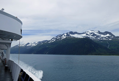
A cruise ship from the Princess Lines heads off down the fjord for a western port of call.
Sunday, July 17, 2016
17 July. On the eve of destruction -- Destruction Bay, Kluane Lake, Yukon
Today was almost our last day in Alaska, but accounting for road systems and geography, the only way to drive to Haines, AK from Tok, AK is though a piece of Yukon and British Columbia. We had super spots on Kluane Lake in Canada's "biocenter" of grizzly bear population. Evidently the week at the RV park had a visit from a Grizzy female and cubs, but as luck would have it, we never saw them.


On 17 July, we re-enter Canada. On 18 July, we re-enter Alaska. On 20 July, we re-enter Canada.

Yukon's largest lake. It was beautiful.

Friday, July 15, 2016
14 July. Valdez, Alaska. Watching Sea Lions rip salmon to shreds.
Valdez (pronouced Val deeez) is a small fishing village. It has a few nice restaurants, a Safeway grocery store, a couple of gas stations, and some majestic scenery. It is also the terminus for the Alaska Pipeline that extends from Prudoe Bay on the north edge of Alaska.


Near the terminus of the pipeline is a salmon hatchery. The place collects eggs and sperm. The hapless salmon are DNA coded to return to the same spot to spawn.

They attempt swimming upstream...

...to this river on the other side of a bridge to the east. But are stopped by a gate ... a "wier," whatever that is ... a gate that stops them.

Waiting in the wings are giant sea lions. I mean huge. Notice in this photo the "Pink Salmon" is peaking out of the water above the sea lion. Bad plan. He won't last long.

The fish are reasonably smart, but are tired from traveling across the Pacific ocean. When they sense the sea lion, they scatter. The dark area is fish so densely packed, you cannot see water between them.

This is a little brutal. Cover the kids' eyes. The sea lion simply dips his head in for a tasty snack. Sea gulls stand by for whatever slings out. And it does. The sea lion shakes from right to left to rip the salmon into bite-sized chunks for swallowing.

Then he does it again. Then again. Think eating french fries at McDonalds. "...I'll just have one more."

And the gulls, mostly Glaucous-winged gulls here, pounce in for scraps.

I'd have to study sea lion behavior, but it looked like there was a pod of smaller ones waiting their turn. That is, waiting for the dominant bull to finish up.

A Black-legged Kittiwake looks at the action.

Black-legged Kittiwakes nest on the nearby bridge.


Most readers will be interested to know how can a birder distinguish between Herring Gulls, Thayer's Gulls and (pictured here) Glaucous-winged gulls. Easy if you can see it. Glaucous-winged gulls have a pink orbital rings, dark irises, and a pink gape. I know most everyone knows this, but I thought I'd review for emphasis. :-)
13 July. On to Valdez Alaska.
Famous for the Valdez oil spill Prince William Sound lived up to its reputation for beauty. We took a short drive from Seward to Whittier though the Whittier Tunnel, a one lane affair that is open one direction for 30 minutes, then the other. Railroad tracks are embedded in the asphalt. It was a little squirrelly driving on them in the tunnel. Then we hoped on one of the ferries that's part of the Alaska Marine Highway ... the Aurora. The trip was 90 miles in 6+ hours, but saved 380 miles of driving. It was expensive. We are not sure we'd recommend it.


Lining up for the ferry ride. We arrived at around 9:45 for a 12:45 departure. There was a lot of standing around. Hurry up and wait.

We were near the last to drive on. ...lots of vehicles, RVs and motorcycles ahead of us. Dory and Bean had to stay below decks. I was able to check on Bean half way through. He was fine.

As we pondered the Exxon Valdez disaster we imagined how much one tanker, even a huge one, could damage this sound. I had imagined for years, some kind of bay swimming in oil, when the reality is a "sound," 100 miles lone and about 15 miles wide. There is, in plain terms, a LOT of water.

Glacier after glacier. The views were mind-boggling.

By now we are tired of seeing glaciers. To paraphrase Ronald Regan, "...seen one glacier, you've seen them all."

Artsy photo required. John, Pam, Richard, Mary and scenery all captured in this one.

We got lucky again with the weather. In an area of North American that sees rain and low clouds more often than not, we had blue sky.

There were a lot of salmon fishing boats in the sound. This one was pretty representative.
12 July, Seward Alaska. Kayaking.
The drive from Homer to Seward was another case of immense beauty. Seward is another port town. We stayed at a US Army Recreation Facility. The good news is it was cheaper than we had been paying, but not necessarily much nicer. John went for a hike alone with the bears. On day two, we all went on a guided kayak tour of a tiny part of Resurrection Bay.


You can't see them, but "Dog Salmon" are spawning in the water behind us.

Pam imitating Mae West. ...oblique humor. Let me know if you get it.

Mary and Richard trying to stay vertical.

The paddles are supposed to be exactly in tandem. So you can see what experts we are.


Note, John is resting, while Pam does the work.

The cabin behind marks a homesteader's claim. He still owns the land on this bay.

Just spectacular scenery.


Two Marbled Murrelets. The Murrelet is one of the few birds who swims underwater using its wings.

Mary in the foreground. Pam and John pulling away.

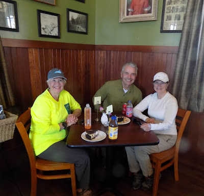
After the kayak tour we ate at a little place called "Zudy's." We chose it to reconnect with a young woman named Cassia who had driven from Denver to Seward in a clapped-out pickup truck by herself. We met her at a construction stop along the Alaska Highway near Muncho Lake in British Columbia. She said, "Stop by and say hello at Zudy's." So we did.
Subscribe to:
Comments (Atom)